 "Scarcity of the water and catastrophic flood disasters would be one of the biggest problems of the world in times to come. Hence I have decided to pursue my postgraduate studies in the field of Hydrology and Water Resources Engineering. With that, I started my Master of Philosophy Degree (MPhil.) at the Dept. of Civil Engineering, University of Peradeniya and completed in March, 2006. Since October, 2006 I have been reading for my Doctoral degree at the Dept. of Urban and Environmental Engineering, Graduate School of Engineering, Kyoto University, Japan."
PhD Research
Tentative Title: Study on the reliability of calibrated distributed hydrological model in the predictions of ungauged sub basins
Summery
Modeling the actual hydrological response of a basin is a difficult task as the actual basin processes are complicated and basin properties change temporally as well as spatially. However, this difficulty can be addressed to some extent by using distributed hydrological modeling approach, which is capable of incorporating the basin heterogeneity, to model the basin hydrological responses. In the case of stream flow prediction by using a distributed hydrological model, at first, it should be calibrated for the basin before using it for the predictions. In the application of a distributed hydrological model, a question arises whether it is possible to use the calibrated model to predict the stream flow at any place within the calibrated basin. In other words, how accurately predictions can be made on stream flow of an ungauged basin, which is a sub basin of a gauged basin, using a distributed hydrological model. Hence, it is important to study the reliability of a distributed hydrological model prediction at different places within a gauged basin towards the stream flow prediction in ungauged basins.
- Study the predictive uncertainty of stream flows at different locations within a gauged basin by using calibrated distributed hydrological model.
- Find out the sensitivity of the model parameters for stream flow prediction at different places within a gauged basin using a distributed hydrological model.
- Find a methodology to transfer the calibrated model parameters of a gauged basin when predicting stream flow at different places within the gauged basin.
- Find the effect of horizontal input grid resolution on the stream flow prediction at different ungauged sub basins within the gauged basin.
- Study on the effect of vertical accuracy of a digital elevation model on spatial stream flow prediction within the gauged basin.
This research is mainly focused on the stream flow prediction in different ungauged locations within a gauged basin by using a distributed hydrological model calibrated to the gauge basin. It is expected to propose a method to calibrate the model to get accurate results for stream flow prediction at ungauged sub basins with predictive error. Furthermore, it is expected to produce a guideline for selecting a proper input spatial resolution when predicting the stream flow at different spatial locations within the gauged basin. Finally, the results of the study is incorporated in the development of transferable distributed hydrological model
MPhil. Research
Title: Setting up of an experimental basin and development of a cell-based model to derive direct runoff hydrographs for ungauged basins- click here to see the summary of the thesis
Abstract
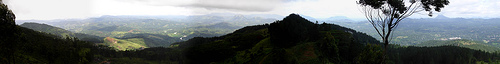
Understanding the hydrological response and quantification of available water in a basin is essential for planning, designing and proper management of its limited water resources. As most of the basins in the world are ungauged, the study is focused to research on stream flow prediction in ungauged basins. An experimental basin was set up selecting the Upper Kotmale basin, which is a tropical mountainous sub basin of the Mahaweli River in Sri Lanka. The basin is 304 km2 in size and the elevation varies from 1200 m to 2500 m above mean sea level. Six automatic high-resolution (0.1mm tipping bucket) rain gauges and three-stream flow measuring stations were installed in the basin and data collection has been carried out since November 2002. Also, the rainfall data over past thirty years period at ten stations in the region was analyzed to investigate their reliability and the daily rainfall data at five stations were found to be inconsistent. Three hydrological models, HEC-HMS model, Tank model and SHER model were calibrated for the experimental basin using past hydro-meteorological data.
A new distributed model, which is applicable to derive direct runoff hydrograph for ungauged basins using spatial physical properties of the basin derived from GIS and rainfall data, was developed. The model was tested using hourly data collected from the experimental Upper Kotmale basin. It is found that the model predicts direct runoff hydrographs for rainfall events with reasonable accuracy. The unit hydrograph obtained from the model was compared with the conventional Snyder's synthetic unit hydrograph obtained using regionalized parameters assuming the basin as an ungauged basin. It is found that the new model predictions are more accurate than the Snyders unit hydrograph predictions and thus, the developed model is a useful tool to obtain direct runoff hydrograph for ungauged basins.
Undergraduate Research
Title: Study on the impact of Walawe Irrigation scheme on lagoons at the downstream end of the Walawe River basin
Abstract
Walawe river basin is located in the south of Sri Lanka and has a drainage area of about 2442km2. Average annual rainfall over the catchments is about 1750mm. The river drains to the sea close to Ambalantota. The average annual outflow to the sea is approximately 1000MCM.
Several development schemes have been built to harness the Walawe river water for hydropower generation and irrigation supply. The uppermost Samanalawewa reservoir has been built mainly for hydropower. Udawalawe reservoir built next supplies irrigation water. Land areas of about 6110ha and 11400ha are supplied with irrigation water on left bank and right bank respectively. Development of further 5340ha on the left bank has been commenced. The most downstream Liyangastota anicut diverts water for irrigation to an area of about 6210ha.
A considerable part of the river water, which originally drained to the sea are now diverted away by these schemes. All drainage waters (which includes surface runoff due to rainfall) from these agricultural lands do not flow back to the river and take diverse paths to the sea. Some flow to the sea through several lagoons. The flora and fauna in and around these lagoons have undergone changes during the last few decades due to this reason.
The study investigated the impact of drainage water on lagoons with respect to water quality. Water quality parameters, temperature, total dissolved solids, conductivity, salinity, dissolved oxygen, and pH of drainage and lagoon waters were collected on monthly basis. The observations indicate that the water coming through Kachchigalara and Miniatiliya drainages have affected Kalametiya lagoon while Lunama lagoon is less affected by the drainage water. The quality of water in the Kachchigalara was observed to be better than those coming from other drainages during the monitoring period.